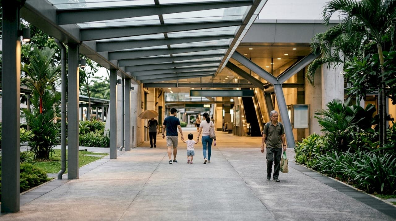
Car-lite living in Singapore means designing everyday trips around walking, cycling and public transport, with a private car as the backup rather than the default. It is not a car-free vision. The Land Transport Master Plan 2040 makes this an official planning direction, so residents should expect more repurposed road space, better cycling links and quieter neighborhoods, while planners are already required to build around these targets rather than around car ownership.
TL;DR:
- The plan to 9 in 10 peak trips being walk, cycle, or ride relies on expanding cycling networks to about 1,300 km by 2030 and redesigning estates like Tengah and Bayshore.
- Infrastructure improvements include sheltered linkways, expanded bike parking, and better segregation of cyclists and pedestrians to increase safety and convenience.
- Pricing policies such as reduced parking, demand-based parking charges, and more precise congestion charges aim to discourage unnecessary car use while maintaining ownership options.
- Households benefit most from a combination of transit passes, car-sharing apps, and bicycles, depending on their specific trip patterns and needs.
- Major developments, like Hougang Central Residences, demonstrate how proximity to transit and integrated amenities support the car-lite lifestyle.
Table of Contents
- Why Singapore is pursuing car-lite: the LTMP 2040 targets
- Where car-lite planning is already happening in Singapore
- Building the hardware: cycling paths, bus lanes and road space
- Pricing and rules that nudge people away from car ownership
- Choosing between ownership, car-sharing and public transport
- Designing car-lite neighborhoods: what planners and developers should prioritize
- What to expect by 2030 and beyond
- Car-lite living's effect on air quality and sustainability
- How car-lite designations shape property values and development
- Common obstacles residents face when going car-lite
- Apps and real-time data that make car-lite trips easier
- Living near transit: what I have noticed and what buyers should check
- Hougang Central Residences: transit-first living in District 19
- Sources
- FAQ
Why Singapore is pursuing car-lite: the LTMP 2040 targets
The Land Transport Master Plan 2040 sets the goal that 9 in 10 peak-period journeys should be completed by walking, cycling or riding public transport, an approach LTA calls Walk-Cycle-Ride. Alongside that headline figure sits a spatial ambition: 20-minute towns, where most daily needs sit within a 20-minute walk or ride, feeding into a 45-minute city where cross-island commutes stay under 45 minutes by public transport.
The rationale is straightforward once you consider the constraints. Singapore has limited land for roads and parking, so every lane given to cars is a lane not given to housing, parks or transit. Car-lite planning treats that scarcity as the starting point rather than an obstacle, and it carries knock-on benefits: fewer short car trips mean more incidental walking and cycling, which planners link to health and quality of life, alongside lower emissions from private vehicle use.
It helps to separate car-lite from car-free early on, because the two get conflated often:
- Car-lite reduces reliance on private cars for routine trips while still allowing car ownership and use where it makes sense.
- Car-free removes private vehicles from an area entirely, a much narrower and rarer approach used in specific precincts or events.
- Singapore's national strategy is car-lite, not car-free: the Land Transport Master Plan 2040 targets a shift in the default mode of travel, not a ban on vehicles.
For residents, this distinction matters because it shapes expectations. You will still be able to own a car under car-lite planning. What changes is how convenient the alternatives become, and how much road space gets reallocated away from driving.
Where car-lite planning is already happening in Singapore
Car-lite is not just a target on paper. As of 2026, Singapore has gazetted 16 car-lite areas, including Tengah, Ulu Pandan, Mount Pleasant, Bayshore and Woodlands North, though many of these are still under construction with major completions expected around 2030. Each estate takes a slightly different approach: Tengah is built around a car-free town center with underground vehicle circulation, while Bayshore and Woodlands North lean on cycling networks and reduced parking ratios tied closely to nearby MRT stations.
Public engagement has been running in parallel with these physical projects. The LTA and MOT's thematic focus group discussions for the LTMP refresh engaged over 7,000 members of the public through online responses, focus groups and outreach. Several themes recurred across those sessions:
- Participants wanted better connectivity between transit nodes and their front doors, not just faster trains.
- Comfort mattered as much as speed, including shelter from rain and heat on walking and cycling routes.
- A sense of community was raised repeatedly as a reason residents supported car-lite precincts over purely car-oriented ones.
- Concrete policy ideas surfaced in these discussions, including COE re-categorisation and other demand-management measures aimed at multiple-car households.
Taken together, these findings suggest the government is treating car-lite as a two-part project: build the infrastructure, then adjust pricing and rules to make the alternative genuinely attractive rather than just available.
Building the hardware: cycling paths, bus lanes and road space
The physical backbone of car-lite living is expanding steadily. LTA's road repurposing program aims to grow the islandwide cycling network to approximately 1,300 kilometers by 2030, converting road shoulders and underused lanes into dedicated cycling paths and widened footpaths. Much of this work also creates Transit Priority Corridors, stretches of road where bus lanes get more hours of operation and traffic signals favor buses over private cars.

New paths generally separate cyclists from pedestrians rather than mixing the two on a single shared strip, a response to the safety concerns raised repeatedly in public consultations. Where full segregation is not feasible, LTA has favored wider shared paths with clearer markings over narrow, ambiguous ones.
The everyday details matter as much as the headline kilometer count:
- Sheltered linkways now connect many HDB blocks directly to MRT stations and bus interchanges, cutting exposure to rain and heat.
- Bike parking has expanded at stations and within estates, often paired with end-of-trip facilities like lockers for helmets and bags.
- Some newer developments include charging points for personal mobility devices, reflecting the wider mix of first-and-last-mile transport people now use.
Pro Tip: Before committing to a car-lite lifestyle, walk your likely daily route at peak hour, not just on a quiet weekend, to see how the paths, shelters and crossings actually perform under real conditions.
None of this replaces the MRT and bus network, it extends its reach. A resident who lives a 12-minute walk from a station, with a sheltered path the whole way, experiences a very different city than one who lives the same distance away on an exposed, narrow verge.
Pricing and rules that nudge people away from car ownership
Infrastructure only gets you halfway. The other half of car-lite policy works through pricing and rules that change the cost and convenience calculus of owning a car. Electronic Road Pricing has long served this function in Singapore, and discussion around an ERP 2.0 system, using satellite-based technology for more precise, distance-based charging, has featured in recent consultations as a tool to manage congestion more directly than the current gantry system.
The Certificate of Entitlement system is also part of the conversation. Focus group discussions for the LTMP refresh raised policy options including COE re-categorisation, potentially differentiating by vehicle value or size, alongside surcharges for households with multiple cars and incentives for shared or leased vehicles rather than outright ownership.
On the public transport side, pricing has moved to encourage take-up rather than discourage it. In April 2026, roughly 23,500 Adult Monthly Travel Passes and 41,800 Senior Citizen Monthly Concession Passes were sold, following a roughly 5% price cut to monthly passes in 2025 aimed at boosting adoption among frequent commuters.
Parking policy rounds out the picture:
- Reduced parking provision under schemes tied to car-lite designations means fewer lots per unit in new developments, a shift buyers should factor into their planning, as explained in this guide to condo parking allocation.
- Lower parking ratios only work well when paired with strong first-and-last-mile options, otherwise residents simply push back or park illegally nearby.
- Some estates use dynamic pricing for on-site parking to discourage all-day private car storage in favor of shared or short-term use.
Choosing between ownership, car-sharing and public transport
Once the infrastructure and pricing context is clear, the practical question for most households is which mix of transport actually saves money and time. The answer depends heavily on trip pattern rather than on any single "best" option.
- Short errands and one-way trips usually favor car-sharing or ride-hailing over ownership, since you avoid parking fees, insurance and depreciation for a trip that might take twenty minutes.
- Occasional weekend trips often still make sense with car-sharing, particularly when a household drives fewer than a handful of times a month.
- Full-day or multi-day use, such as a family trip out of the city or moving furniture, tends to tip the economics toward traditional car rental or ownership, since per-hour car-sharing costs compound quickly against a flat daily rental rate.
- Daily commuting to a workplace reachable by MRT or bus rarely justifies car ownership at all once you account for COE, insurance, parking and fuel against the price of a monthly travel pass.
A car costs money every day it sits in a parking lot, whether or not you drive it. A shared car or a transit pass only costs money when you actually use it.
Micromobility fills the gaps that public transport cannot reach efficiently, particularly the first and last few hundred meters between a station and your front door. Bicycles and personal mobility aids work best here when paths are segregated and well lit, which is precisely what the newer cycling network extensions aim to provide.
For a household trying to design a genuinely car-lite mix, the practical approach is usually to keep a public transport pass as the default, add a car-sharing or ride-hailing account for occasional need, and treat a bicycle or personal mobility device as the connector for the final stretch of any trip.

Designing car-lite neighborhoods: what planners and developers should prioritize
Good car-lite outcomes rarely happen by accident. Planners and developers who want a precinct to function without heavy car dependence tend to focus on a consistent set of design moves.
- Locate residential blocks and retail within direct walking distance of an MRT station or major bus interchange, ideally under a sheltered path.
- Cluster daily amenities, groceries, clinics, childcare, so a resident's routine needs sit inside a short walk rather than requiring a car trip.
- Reduce parking ratios deliberately, but only where first-and-last-mile infrastructure is strong enough to absorb the difference.
- Build wide, well-lit active mobility routes that separate cyclists from pedestrians rather than forcing them to share a narrow path.
Operationally, this also means planning for maintenance and inclusivity from day one: covered walkways need regular upkeep, secure bike parking needs monitoring, and paths need to accommodate wheelchairs, prams and elderly residents, not just able-bodied commuters in a hurry.
Hougang Central Residences illustrates several of these principles in a built context. The development sits directly above Hougang MRT station, with 835 residences ranging from one-bedroom units to five-bedroom penthouses integrated with a retail mall and bus interchange. That direct transit adjacency, paired with tropical landscaped communal areas and smart-home systems, reflects the kind of amenity clustering planners aim for when reducing car dependence: daily needs, transport and home sit within the same footprint rather than spread across separate car trips. More detail on how the site connects to the surrounding network is available in the location and connectivity guide.
Pro Tip: When assessing a development's car-lite credentials, check whether transit access is a short covered walk from the residential lobby, not just "nearby" on a map.
What to expect by 2030 and beyond
The next few years bring concrete, checkable milestones rather than vague promises. The cycling network expansion to roughly 1,300 kilometers is targeted for 2030, alongside completions at several of the gazetted car-lite precincts, though HDB has flagged that many of these estates remain under development with impact assessments ongoing.
Beyond 2030, the Land Transport Master Plan 2040 horizon is when the 9-in-10 Walk-Cycle-Ride target and the 20-minute town, 45-minute city ambitions are meant to fully materialize. Reaching that point depends on continuous evidence gathering rather than a single rollout:
- MOT has signaled ongoing studies into the effectiveness of car-lite designations since 2019, drawing lessons from early implementations before scaling further.
- LTA's shadowing studies and thematic focus groups are expected to keep feeding into policy adjustments as the LTMP refresh continues.
- HDB evaluations of gazetted estates will likely determine which design elements get repeated in future precincts and which get revised.
For residents and planners tracking progress, these government studies and consultation outputs are the most reliable way to see whether car-lite planning is delivering the modal shift it targets, rather than relying on anecdotal impressions of any single neighborhood.
Car-lite living's effect on air quality and sustainability
Shifting routine trips away from private cars reduces the number of vehicle-kilometers driven within residential estates, and fewer short car trips generally means lower local emissions of exhaust pollutants and less noise in the immediate neighborhood. This is one of the underlying reasons the Land Transport Master Plan 2040 frames car-lite as a liveability strategy rather than purely a congestion fix.
Walking and cycling infrastructure also does double duty as green infrastructure when it is designed well. Tree-lined paths and landscaped verges that accompany many of the newer cycling routes add shade and greenery to areas that previously carried more road surface, which supports both the softer acceptance measures researchers point to and the harder emissions goals tied to national climate commitments.
None of this means private vehicles disappear from the sustainability equation. Car-lite planning coexists with continued electrification of Singapore's vehicle fleet, and the two strategies work on different levers: one reduces how much people need to drive, the other reduces the emissions per trip when they do. Residents who shift even a portion of their routine trips to walking, cycling or transit contribute to both goals without needing to give up car ownership entirely, consistent with the car-lite rather than car-free framing that underpins national policy.
How car-lite designations shape property values and development
Transit adjacency has long carried a premium in Singapore's property market, and car-lite designations tend to reinforce that pattern rather than create a new one, as detailed in this marketplace insights article. Estates built around strong Walk-Cycle-Ride access, reduced car dependence and integrated amenities generally appeal to buyers who value convenience and lower recurring transport costs, which developers factor into planning decisions from an early stage.
Reduced parking ratios, one of the more visible features of car-lite precincts, change the economics of a development on both sides. Developers can allocate more of a site to residential space, retail or communal amenities rather than parking structures, while buyers weigh the trade-off of fewer dedicated car lots against stronger transit and active mobility access. This is a genuine consideration worth checking early, as outlined in the guide to condo parking allocation under newer policies.
Urban development around gazetted car-lite areas also tends to prioritize precinct-level planning over piecemeal individual projects. Tengah's car-free town center and the cycling-first design at Bayshore and Woodlands North both reflect a masterplan approach where transport, housing and retail are planned together, a pattern also visible in Hougang's own district planning, detailed in the Hougang masterplan guide. For buyers evaluating long-term value, transit integration and precinct-level amenity planning are worth weighing alongside unit size and finishes.
Common obstacles residents face when going car-lite
Switching to a car-lite routine is rarely a single decision, it is a series of small adjustments, and several obstacles show up consistently. Weather is the most immediate one: Singapore's heat and sudden rain make uncovered walking or cycling routes genuinely unpleasant, which is why sheltered linkways featured so heavily in public consultation feedback.

Infrastructure gaps are another common barrier. Not every neighborhood has finished cycling paths or covered walkways yet, since much of the network expansion is still underway toward its 2030 target, so residents in older estates may find the car-lite experience considerably rougher than in newer, purpose-built precincts.
Household logistics add friction too. Families with young children, elderly relatives or mobility needs often find that a single car trip solves a problem that would otherwise require several separate transport legs, and pure car-lite living can feel harder to sustain during specific life stages even when it works well the rest of the time.
Finally, there is a genuine mindset shift involved. Decades of car-centric planning shaped expectations around convenience and status, and moving away from that requires more than infrastructure. It requires residents to trust that the alternative, walking, cycling or public transport, will reliably get them where they need to be on time, which is exactly the kind of confidence that ongoing infrastructure and pricing adjustments are designed to build.
Apps and real-time data that make car-lite trips easier
Technology has quietly become one of the more practical supports for car-lite living, mostly by removing uncertainty from trips that used to require guesswork. Real-time bus and train arrival information lets residents time their walk to a stop or station rather than waiting around, which matters more than it sounds when the alternative to a five-minute wait is deciding to just drive instead.
Fare payment has also simplified considerably with contactless systems like SimplyGo, which let commuters tap in and out across buses and trains without needing separate tickets or top-ups for each mode. That kind of friction reduction supports the broader shift toward treating public transport as the default rather than a fallback.
Car-sharing and ride-hailing apps fill the remaining gap for trips that genuinely need a car, letting residents book a vehicle only when required rather than maintaining one they use a handful of times a month. Route-planning apps that combine walking, cycling and transit options into a single suggested journey also make the Walk-Cycle-Ride approach easier to plan around, particularly for trips that involve more than one mode. None of these tools replace the physical infrastructure discussed earlier, but they make it considerably easier to actually use what has already been built.
Living near transit: what I have noticed and what buyers should check
Transit-integrated living changes daily rhythms in ways that are easy to underestimate before you experience them. A short, sheltered walk to a station tends to replace small car trips almost by accident, not because anyone decided to be car-lite on purpose, but because the alternative stopped being more convenient.
For buyers evaluating a car-lite-friendly condo, a few checks matter more than glossy brochures suggest:
- How much of the walk to the nearest MRT station or bus interchange is actually sheltered.
- Whether daily amenities, groceries, clinics, food options, sit within the development or a short walk away.
- What the cycling and pedestrian paths look like at peak hour, not just on a quiet afternoon.
A closer look at what to check before buying near a major transit hub is covered in this guide to living near a bus interchange, which is worth reading alongside any site visit.
— Simon
Hougang Central Residences: transit-first living in District 19
For buyers who want the car-lite equation solved before move-in day, Hougang Central Residences sits directly above Hougang MRT station, with an integrated retail mall and bus interchange built into the same site. That means the sheltered walk from your front door to a train or bus is measured in minutes, not the usual uncertain stretch of open pavement.
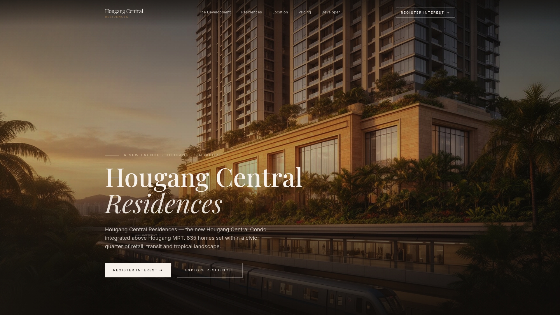
The development offers a range of residences spanning various unit sizes, catering to different needs such as short commutes, access to amenities within walking distance, and options for those who prefer less dependence on driving. The residences include quality fittings and smart-home systems, complemented by landscaped communal spaces that provide residents with attractive outdoor areas. A planned MRT interchange nearby is expected to enhance long-term transit connectivity in the area.
If the connectivity details matter to your decision, the location page breaks down exactly how the site links to the surrounding transport network. Prospective buyers ready to look at unit types and current pricing can check the residences page or view pricing starting from $2,800 SGD per square foot on the pricing page.
Sources
- Land Transport Master Plan 2040 (LTA eReport)
- HDB: Four public-housing estates zoned as car-lite areas
- MOT: Data on quantity and usage of monthly travel passes and targeted promotion
FAQ
What does "car-lite" mean in Singapore?
Car-lite means designing daily life so that walking, cycling and public transport handle most routine trips, while private car ownership remains allowed rather than banned. The Land Transport Master Plan 2040 frames this as a Walk-Cycle-Ride target for 9 in 10 peak-period journeys, distinct from a car-free approach, which removes vehicles entirely from an area.
What is the car-lite strategy in Singapore?
Singapore's car-lite strategy combines infrastructure, gazetted precincts and pricing tools to shift routine trips away from private cars. It includes expanding the cycling network to roughly 1,300 kilometers by 2030, designating car-lite estates such as Tengah and Bayshore, and exploring pricing measures like ERP 2.0 and COE adjustments raised in recent public consultations.
Is car-lite living cheaper than owning a car in Singapore?
For residents who mostly take short trips or commute by transit, a mix of public transport passes and occasional car-sharing tends to cost less than maintaining a private vehicle, since ownership carries fixed costs like COE and parking regardless of use. Households with frequent full-day or multi-day driving needs may still find ownership or traditional rental more economical than repeated short-term car-sharing.
How much does a monthly travel pass cost in Singapore?
Exact monthly pass pricing is set by the Public Transport Council and is not listed in this article, but uptake data shows roughly 23,500 Adult Monthly Travel Passes were sold in April 2026 following a price reduction in 2025 aimed at encouraging adoption. Readers should check current fares directly with the Public Transport Council or SimplyGo for up-to-date pricing.
Which areas in Singapore are designated as car-lite?
As of 2026, 16 areas across Singapore have been gazetted as car-lite, including Tengah, Ulu Pandan, Mount Pleasant, Bayshore and Woodlands North. Many of these estates remain under development, with major completions and full impact assessments expected around 2030.